Illaunloughan
Early Christian site
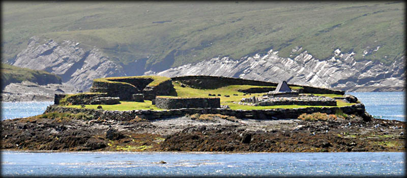
Illaunloughan-Oileán Lócháin, is the smallest of the islands off the west coast of Ireland, that bear early ecclesiastical foundations. A monastery was established here in the second half of the 7th century. The island is situated in the Portmagee Channel about 350 metres west from the town. tourists travelling to Skellig Michael would sail close the island. This was the second of three island sites we visited in three days. It took quite awhile to find a local fisherman who was willing to take us out there, for a small fee, but our perseverance was well rewarded. It was a beautiful day, the quartzite that surrounds the tomb shrine was sparkling in the evening sun and could be easily seen from the mainland.
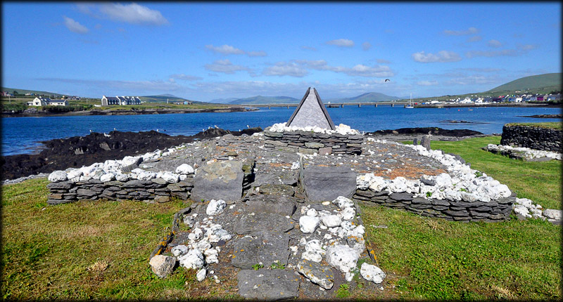
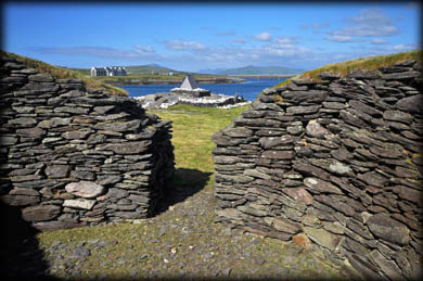
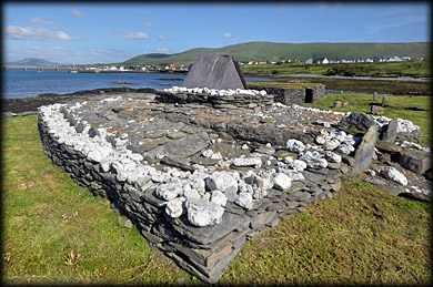
During the first period of activity on the island the monks built an enclosure with three hut sites, A, B, and C, nestled inside the western enclosure wall, a sod-walled oratory, leachta and a tomb-shrine. The sod oratory was later replaced by the drystone oratory, pictured below right. During this period the largest hut structure, D, was was built. For me personally the most exciting monument was the large, 9m long by 7.5 m wide, rectangular leacht with the gable-shrine. I had seen the gable shrines at Killoluaig, Temple Cronan and Slane, but nothing compared to this one. The gable-shrine was built in the 8th century, during the second period of activity on the island, it replaced an earlier shrine.
Looking east from hut D
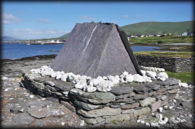
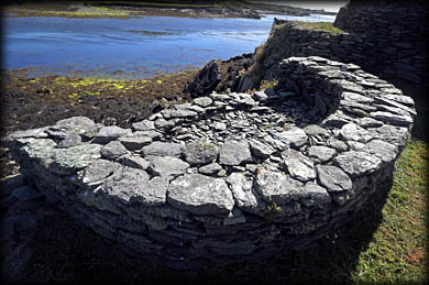
The gable-shrine
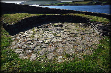
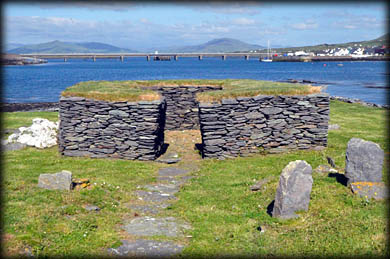
Hut A
Hut D
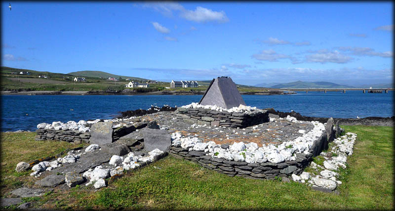
Three graves were found during excavations of the gable shrine, these may have been where the original founders or Saints of the monastery were buried, under the first shrine. The gable-shrine had an entrance on the western side all four sides were kerbed by stones and lined on the inside with quartz. Two small stone cists were found within the shrine, they each held the bones of an adult, but one also contained the bones of a child, all three dated between 660 and 780 CE. Part of the shrine mound was also used as a cemetery for the monks. The gable-shine was constructed using slate. A truly wonderful site, strongly recommended.
From the north west
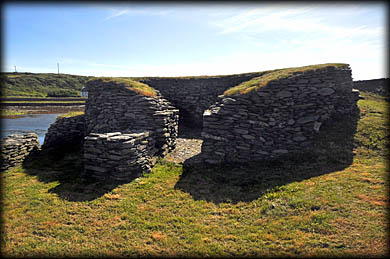
Drystone oratory
Hut C
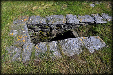
A well
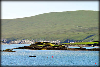
A view of the island, looking west, from the bridge that connects Valentia Island to the mainland. Run the mouse of the image for the location of the various monuments. The well, not visible, is situated between hut C and the Oratory.
Situated: In the Portmagee Channel, about 350 metres west of the town. You will have to find a local fisherman willing to take you, enquire on the quay at Portmagee. There is no landing pier on the island, you will have climb slippery rocks. Good shoes/boots essential.
Discovery Map 83: V 3361 7314. Last visit June 2018.
Longitude: 10° 22' 25" W
Latitude: 51° 53' 12" N
Photos: Jim Dempsey.