 |
|
|---|---|
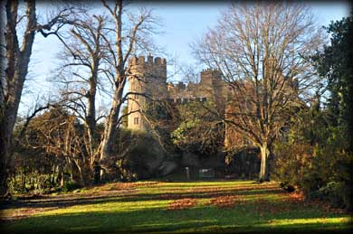
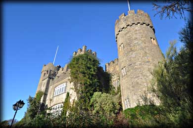
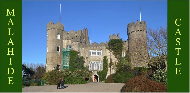
Malahide Castle Remarkably the Talbot family resided at this castle from 1185 up until 1973, except for a period between 1653 and 1665 when Oliver Cromwell confiscated the castle and granted it to Miles Corbet. Corbet was one of the members of Parliament who signed the death warrant for Charles 1. After the restoration of Charles 11 to the throne Corbet was executed and the castle was restored to the Talbot family. The medieval castle, which was built on the Land granted to the family by Henry 11 in 1174, is now hidden behind the Georgian Gothic style rebuild that took place in c.1760. The two distinctive corner towers were added at this time. The castle was renovated in the 19th century and sold to the state in 1975. |
|
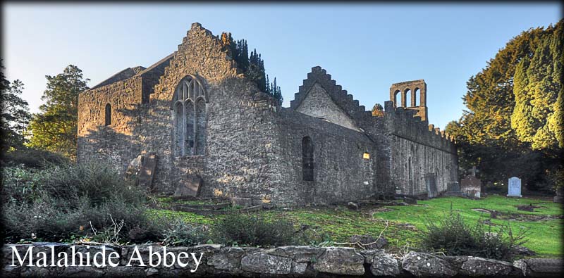
Adjacent to the castle is the nave and chancel church dedicated to St Sylvester. The 17 metre long nave has stepped battlements on the side walls and the 9 metre long chancel has a sacristy attached to the southeast corner. There is a triple bell cote above the west gable. In the east gable there is a 15th century triple light traciery window. Inside the church is the 16th century altar tomb with recumbent female effigy, said to be that of Maud Plunkett, and a red sandstone stoup. |
|
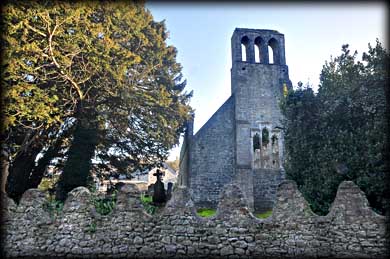 |
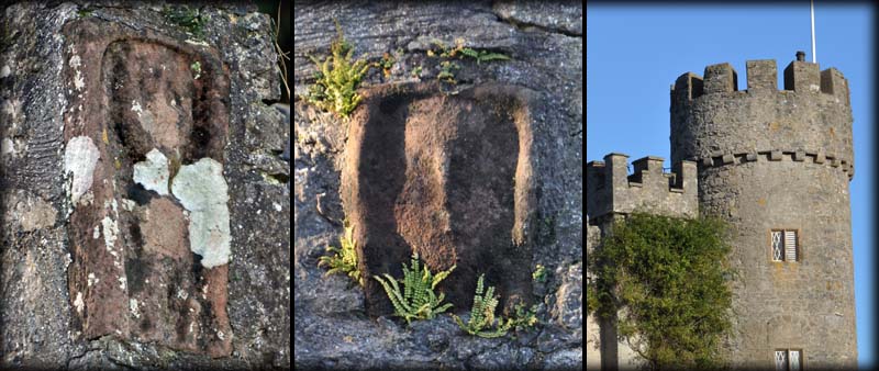
During a clean up in 1954 a Sheela-na-gig was discovered on a quoin at the north-east angle of the church. The figure is carved in red sandstone and is set within a frame. The carving has suffered from weathering since the protective covering of ivy was removed from the building. You can see the left hand resting on the thigh and make out the slit representing the vulva. The facial features are very worn. Located at the south-west of the gable next to the sacristy is another carving in red sandstone believed to be the head of another Sheela-na-gig. The body appears to have been broken off from the original stone. |
The sheela-na-gig, and in the centre the head of a possible second sheela-na-gig, plus one of the corner towers. |
|
Situated: From Dublin head north on the Malahide Road (R107). After 10.5k turn right onto Back Road when you see the sign for the castle. The entrance is 800 metres down here on your left. Discovery OS Map 50: O 2193 4543. Last visit Dec 2013. Longitude: 6° 9' 53" W Latitude: 53° 26' 42" N Photos: Jim Dempsey. |
|