Kilmolash
Parish Church and Ogham Stone
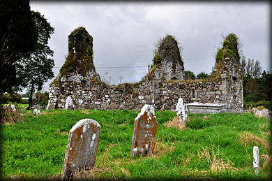
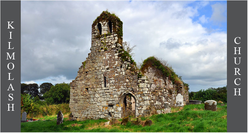
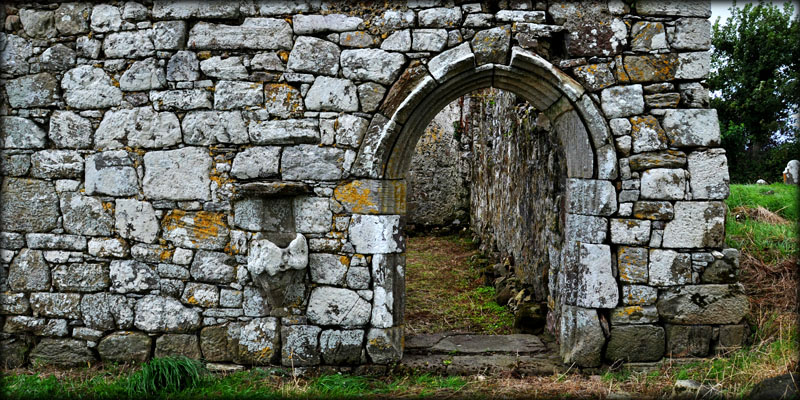
The multi-period medieval parish church of Kilmolash stands within a D-shaped graveyard. This maybe the site of an early monastery founded by St Molaise in the 6th/7th century. Kilmolash is derived from Cell-Mo-Laise meaning Church of Molaise. It is situated near two ancient roads, the "Saints Road"-Bóthar-na-Naoimh and the "Track of St Patrick's Cow"-Rian bó Phádruig, a road that ran from Ardmore to Cashel, via Lismore. The monastery was plundered by vikings in 833CE and in 912CE Cormac Mac Cuileannan, bishop and vice abbot of Lismore, King of Déisi and abbot of Cell-Mo-Laise was killed here.
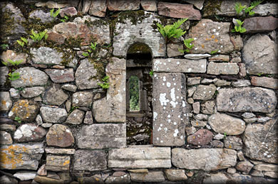
Window in the south wall of the chancel
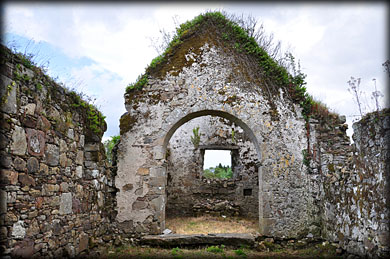
Chancel Arch
The north and south walls of the chancel are 12th century and the rest of the chancel and nave is probably 15th century. I loved the pointed doorway and font built into the west wall, pictured above. The light was not great during my visit, these pics were taken between showers. I will definitely call back, even if just to see the font again. A single ogee headed window and a double belfry are also present on the west wall. I believe there is a graveslab with the head of an ecclesiastic present in the graveyard, but I had to leave because of a heavy downpour, it's another reason to call back.
Inscribed/Decorated stones
There are a number of interesting decorated stones at Kilmolash. The 12th century romanesque rosette, pictured below right, is carved on sandstone and inserted above a lintelled doorway in the 15th century north wall of the nave. A stone on the north pier of the chancel arch, pictured below left, bears the following inscription: FEARE GOD, HONER THE KINGE, ANNO DOM 1635. I believe the lintel, above the window in the north wall of the chancel, bears a cross in false relief, but I failed to see it on my visit, it may be hidden under moss. A graveslab bearing a cross in relief, has been built into the SW corner of the nave.
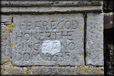
17th century inscription
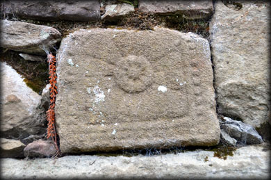
Rosette stone
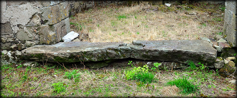
This stone was identified by Macalister 1945, as an ogham stone. He read the letters NN around the bulge to the left in the nearest edge pictured above. He also noted an inscribed pattée cross at the northern end of the three metre long stone, with two simple crosses inscribed on each side. The stone has been used as a step between the nave and the chancel, and is now extremely worn. I could see the inscribed crosses, but could see no sign of an ogham inscription.
Situated: From Lismore head east on the N72 for 7.5 kilometres. Then keep right following signs for Clashmore/Aglish/Villierstown. After 1.9K turn left. Then stay right c.850 metres. Go 2.8 Kilometres. The church is at a junction on your left.
Discovery Map 82. X 1306 9471. Last visit Sept 2019.
Longitude: 7° 48' 34" W
Latitude: 52° 6' 16" N
Photos: Jim Dempsey.